Georgia
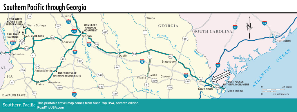
Running across the middle of Georgia, US-80 follows the “fall line,” a geological divide where rivers drop in a series of rapids from the higher Piedmont Plateau to the lower coastal plain. Because the fall line marked the limits of navigation in from the sea, settlements naturally sprung up along it: Columbus was founded on the banks of the falling Chattahoochee, while in the middle of the state, Macon was built along the Ocmulgee River. These, the third- and fourth-biggest cities, respectively, in this still-rural state, are the only real cities our route passes through, and both are fascinating places in different ways.
For the rest of its trip across Georgia, US-80 takes in more than 300 mi (485 km) of rolling countryside, speckled here and there with dozens and dozens of small towns. Runs along ancient-looking two-lane blacktop wind through thick hardwood-and-pine forests, past stately white-columned farmhouses with wide lawns and run-down tin-roofed shacks with yards full of rusting refrigerators and old bangers on blocks. Especially in the western half of the state, US-80 runs across rolling Piedmont countryside past extensive orchards at the heart of Georgia peach country. Follow U-pick signs in early summer for a field-fresh selection, or stop at roadside stands selling the Georgia specialty along with other local fruits and vegetables, including, of course, peanuts. You can detour to explore the surprisingly simple homes of two U.S. presidents, Franklin Delano Roosevelt’s at Warm Springs and Jimmy Carter’s at Plains.
Continuing east toward Savannah and the Atlantic Coast, US-80 has been replaced by the much faster I-16 freeway, bypassing numerous small towns across an agricultural region that was devastated during General Sherman’s Civil War “March to the Sea.” Fortunately, Sherman spared the colonial capital, Savannah, a lushly verdant gem generally considered among the most beautiful cities in North America.
Map of the Southern Pacific Route through Georgia


