Depoe Bay to Newport
Depoe Bay
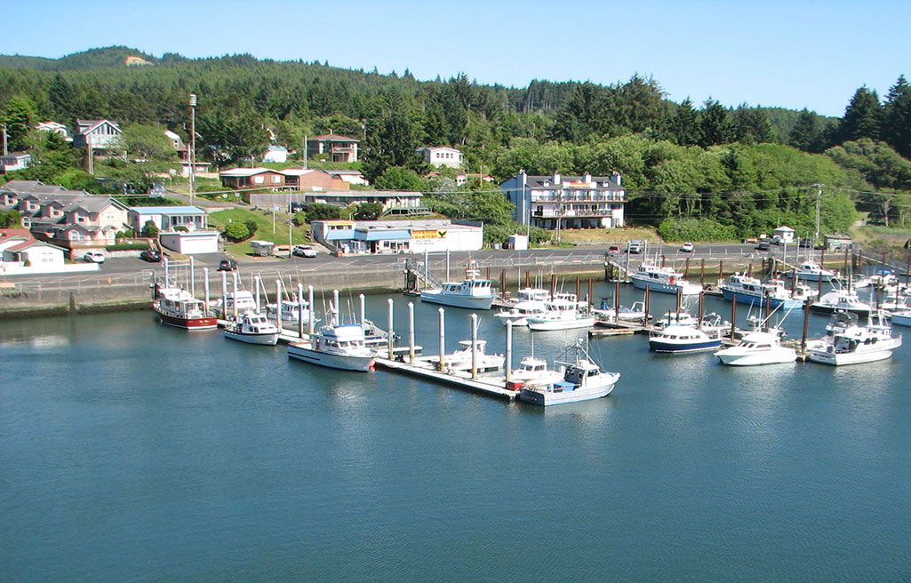
Depoe Bay has an appeal, but so much of its natural beauty is obscured from the highway by gift shops or intruded upon by traffic that you’ve got to know where to look. In his book Blue Highways, William Least Heat-Moon wrote “Depoe Bay used to be a picturesque fishing village; now it was just picturesque.” While it’s true that most of the commercial fishing is long gone, you can still park your car along the highway and walk out on the bridge to watch sportfishing boats move through the narrow channel in and out of what the Guinness Book of Records rates as the world’s smallest navigable natural harbor.
Gracie’s Sea Hag Restaurant & Lounge restaurant (541/765-2734), on US-101 in downtown Depoe Bay, is a time-tested breakfast place—run by the same people for more than 40 years. For a place to stay, try the popular Inn at Arch Rock (70 NW Sunset St., 541/765-2560 or 800/767-1835, $99 and up).
Cape Foulweather & the Devil’s Punchbowl
Between Depoe Bay and Newport, the roadside scenery along US-101 and the parallel “old road,” now signed as the Otter Crest Loop, is dominated by miles of broad beaches and sandstone bluffs, including the 500-foot headland of Cape Foulweather, named by Captain James Cook and offering a 360-degree coastal panorama. The Otter Crest Loop has frequently been closed by slides and reconstruction efforts, but you can reach it from many access roads. With fine old bridges and numerous vistas, it’s a great drive or bicycle route.
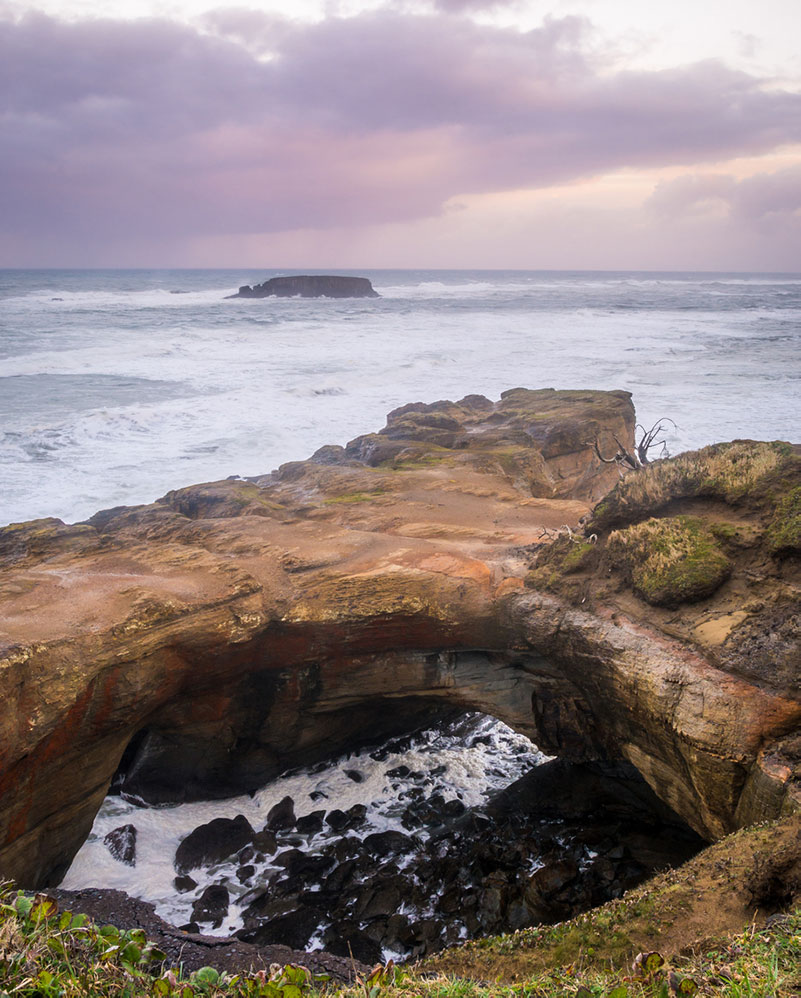
Farther south, midway between Depoe Bay and Newport, the aptly named Devils Punchbowl gives a ringside seat on a frothy confrontation between rock and tide. In the parking area you’ll find a small lunch café. Other than its famous clam chowder, the claim to fame of this branch of Newport’s Mo’s remains a visit from Bruce Springsteen on June 11, 1987.
Newport
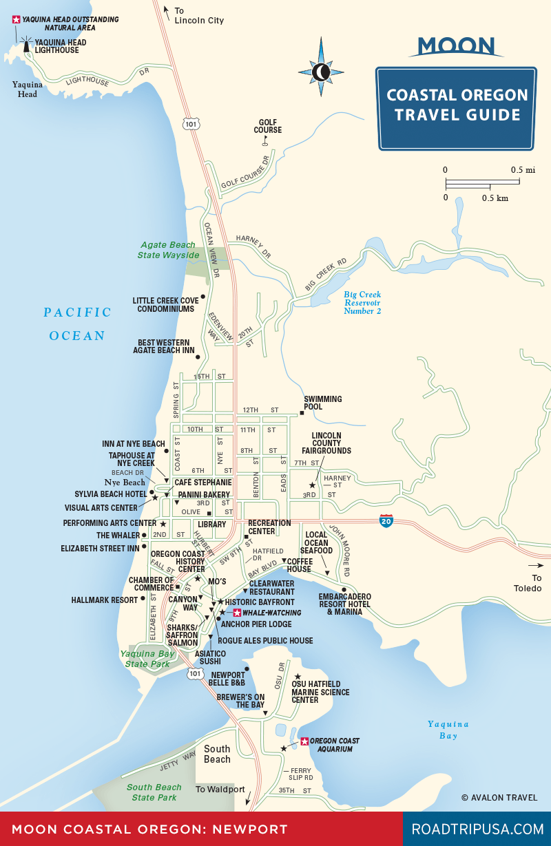
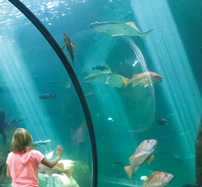
Another old fishing community turned tourist nexus, Newport (pop. 9,989) became popular in the 1860s on the strength of sweet-tasting Yaquina Bay oysters, which were in demand from San Francisco to New York City and are still available at local restaurants. Oysters, crabs, and clams, along with sea otters, sea lions, sharks, and seabirds, are the stars of the show at the large and modern Oregon Coast Aquarium (541/867-3474, daily, $23 adults), south of Newport across the Yaquina Bay Bridge. The aquarium includes an aquatic aviary, where tufted puffins and other shorebirds cavort in a simulated rockbound coastal habitat, and over 40,000 square feet of similarly ecofriendly exhibits, many of them outdoors.
On the north side of the US-101 bridge over Yaquina Bay, turn onto Hurbert Street and head for the bayfront, where boatyards and fish-packing plants service a working harbor. Though it’s still one of the state’s largest fishing ports, much of Newport’s bay front has been consumed by souvenir shops, a wax museum, a Ripley’s Believe It or Not, and other tourist traps. But you’ll also find the original Mo’s (622 SW Bay Blvd., 541/265-2979), a locally famous seafood restaurant.
North of the harbor is Nye Beach, an interesting mélange of old-fashioned beach houses and destination resorts on the western side of US-101. The Nye Beach Café (526 NW Coast St., 541/574-1599) serves fresh local fare. The bohemian Sylvia Beach Hotel (267 NW Cliff St., 541/265-5428, $120 and up) is the place to stay in Newport for anyone of literary bent. All rates include breakfast. Sumptuous dinners are available too.
Newport Travel Map
