Mennonite Country
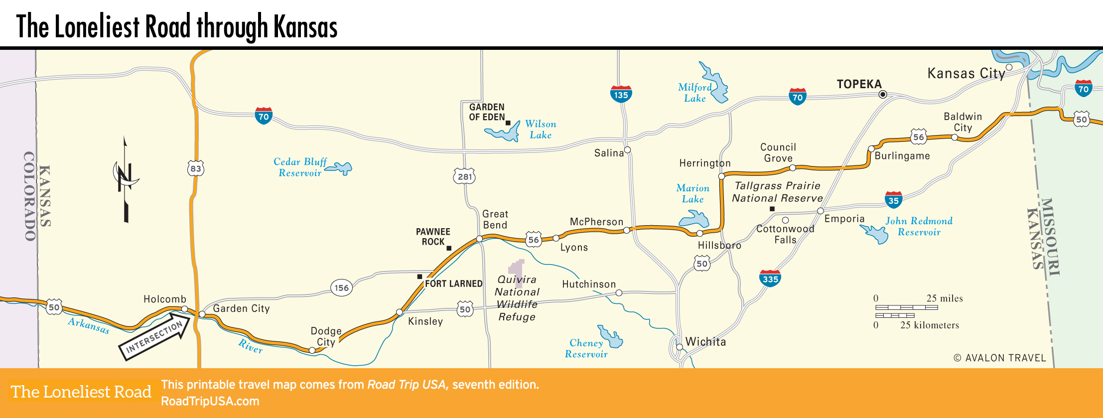
McPherson
From a distance across the flat plains, the towering grain elevators make McPherson (pop. 13,077), about 30 mi (48 km) east of Lyons and marking the junction of US-56 and I-135 between Salina and Wichita, look more impressive than it really is. You can fill the gas tank or get a bite to eat (all the usual franchise food places and gas stations are here) or just stretch your legs wandering around the four-block Main Street business district.
The small McPherson Museum (1111 E. Kansas Ave., 620/241-8464, 8am-5pm Mon.-Fri., 11am-5pm Sat., $5), well-marked in a residential district, displays rooms furnished in typical turn-of-the-20th-century Kansas style. It also holds the world’s first artificial diamond, produced by Willard Hershey, a local chemistry teacher.
Mennonite Country
One of the centers of the sizable local Mennonite community, Hillsboro (pop. 2,934), 13 mi (20.9 km) west of US-77, serves as market center for the area’s highly productive farmlands. Tabor College, on the east side of town, is the most visible sign of the Mennonite presence; although it’s a coed nondenominational college, about half the students are local Mennonites.
The tidy town of Goessel (pop. 501), about 15 mi (24 km) southwest of Hillsboro, was also founded by Mennonite farmers and now holds the worthwhile Mennonite Heritage and Agricultural Museum (200 N. Poplar St., 620/367-8200, Tues.-Sat., $5), where numerous buildings, including two schools, a barn, and a bank, have been moved for preservation. The flat black earth around Goessel is among the world’s greatest producers of wheat, in particular the hardy hybrids able to withstand the Midwestern winter. The original seed, known as “Turkey Red,” was brought to Kansas in the early 1870s by Russian Mennonites who immigrated here after their 100-year exclusion from military service was rescinded.
Zigzagging east from Hillsboro and then north along US-77/US-56, after another 37 “level” mi (60 km), US-56 reaches the town of Herington. Its central square holds a monument to Juan de Padilla, who passed through southern Kansas in search of the mythical Golden City of Quivira as part of Coronado’s expedition.
Related Travel Guides