California
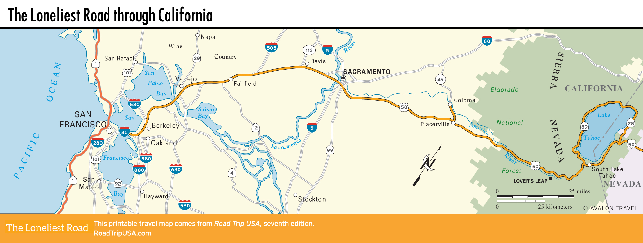
Heading east from San Francisco across the heavy-duty Oakland Bay Bridge, the route across California starts off along the busy I-80 freeway through the urbanized San Francisco Bay Area. Passing diverse bay-front towns, including blue-collar Oakland and collegiate Berkeley, the busy and often congested eight-lane highway heads northeast across the historically important but increasingly suburbanized flatlands of the Sacramento Delta.
Beyond Sacramento, the state capital of California, US-50 finally emerges, first as a freeway but later as a two-lane mountain road climbing through the heart of the Sierra Nevada foothills, where many of the small towns slumber in a gold-rush dream of the 1850s. Continuing east, US-50 winds through endless tracts of pine forest before cresting the Sierra to reach alpine Lake Tahoe, a year-round resort lying astride the California-Nevada border.
Related Travel Guides