Port Gibson to Emerald Mound
Port Gibson
One of the many little gems of the GRR is 30 mi (48 km) south of Vicksburg: Port Gibson (pop. 1,348), the town General Grant found “too beautiful to burn.” As they did with Savannah, Georgia, the Union Army spared Port Gibson during the Civil War. Decades of economic doldrums have spared the town from the Walmart sprawl that at times seems to have enveloped the rest of the South. Fine homes still grace the pleasantly shaded main drag, but most eye-catching is the giant Monty Python prop known as the Church of the Golden Hand because its steeple is topped by a gold-leafed hand, its index finger pointing the way to heaven. Actually, this is the circa-1859 First Presbyterian Church (601/437-5428), whose interior is lit by the gasoliers of the famous steamboat Robert E. Lee, the record-setting winner of the Great Steamboat Race of 1870. Newspapers of the day reckoned that millions of dollars were wagered on the outcome of the New Orleans-to-St. Louis race, which attracted international attention. The Lee’s three-day, 18-hour, and 14-minute victory was an upset for the favored title holder, the Natchez.
Across the street from the Golden Hand, next to a gas station, stands another unusual building, Temple Gemiluth Chassed, an elaborate Moorish-arched temple built in 1892 by Port Gibson’s then large and prosperous Jewish community.
The Natchez Trace Parkway
A mile or so (1.6 km) south of Port Gibson, US-61 and the GRR cross the much more relaxed Natchez Trace Parkway, which, like the Blue Ridge Parkway, is a scenic route managed by the National Park Service. The parkway follows the route of the old Natchez Trace, a pre-Columbian path that grew into the major overland route between the Gulf Coast and the upper Mississippi and Ohio River Valleys in the years before steamboats provided a faster alternative. The Natchez Trace appeared on maps as early as 1733, and from the 1780s to the 1820s, it was one of the nation’s most traveled routes. Farmers and craftspeople in the Ohio River Valley would transport their products by raft downstream to Natchez or New Orleans, then return on foot, staying at the dozens of inns along the route while doing battle with swamps, mosquitoes, and bands of thieves.
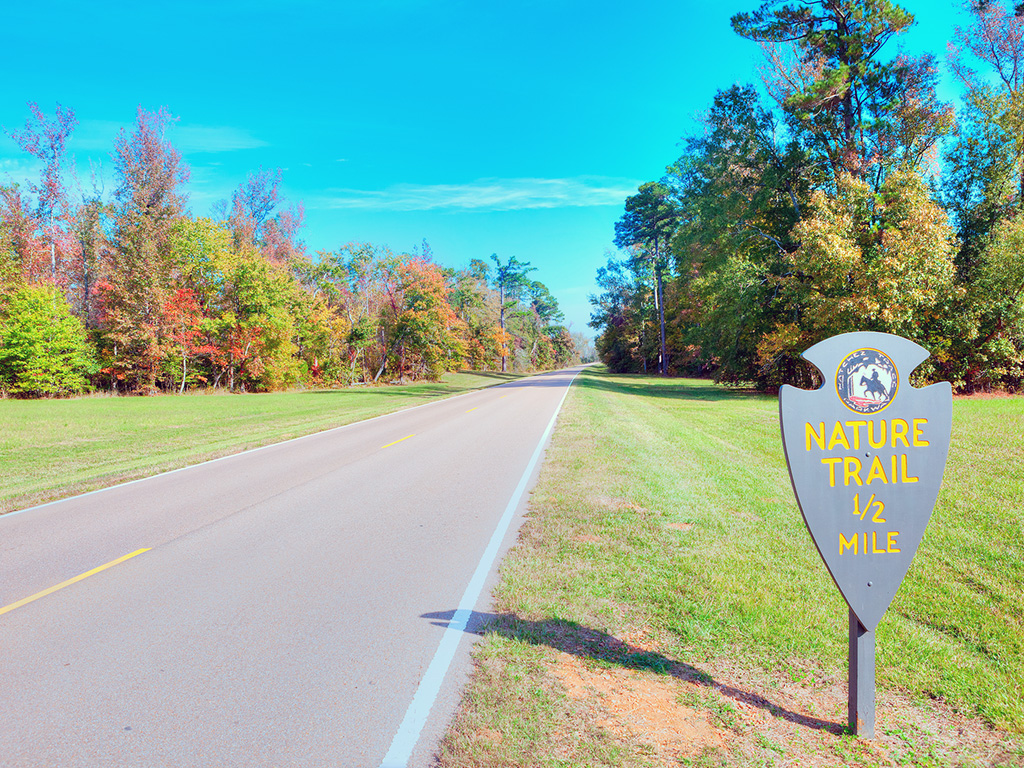
The entire 444-mi (715-km) length of the parkway, which runs from Nashville south to the edge of Natchez, with a short break around Jackson, is well paved and makes a delightful driving or riding route, with places of interest marked every few miles. Just north of Port Gibson at milemarker 41.5, the Sunken Trace preserves a deeply eroded 200-yard-long section of the trail, the canopy of moss-laden cypress trees offering one of the most evocative five-minute walks you can imagine. Between Port Gibson and Natchez, sights along this short and eminently bikable stretch include the prehistoric Emerald Mound, the second-largest ceremonial mound in the United States, which dates from around AD 1250 and offers a commanding view of the woodlands. Mount Locust, at milemarker 15.5, is a restored roadhouse and visitors center and the best place to pick up parkway information.
The National Park Police keep the parkway under thorough radar surveillance, by the way, so try to stay within the posted speed limit, generally 50 mph (81 km/h).
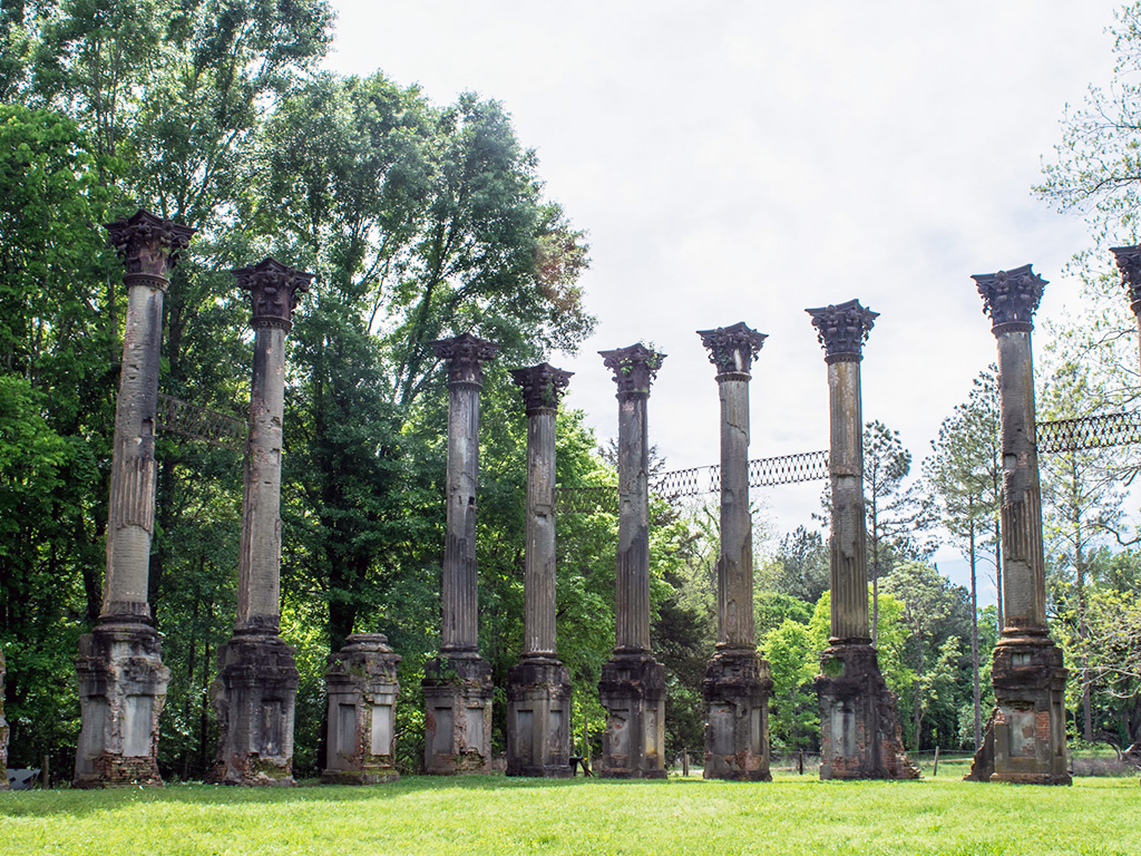
The Ruins of Windsor
Emerald Mound
Another enigmatic ruin is farther south, nearly invisible in the lush growth: Emerald Mound (daily), a prehistoric platform over 400 ft (122 m) wide and 35 ft (10.1 m) tall. The second-largest mound in North America, it was built around AD 1250 and was still in use as a ceremonial center when the first Europeans arrived; Emerald Mound is located on Hwy-553 just west of Natchez Trace Parkway milepost 10.3.
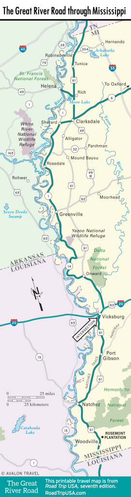
Map of the Great River Road in Mississippi
Related Travel Guides