
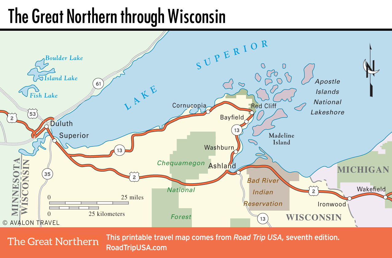
Hwy‑13 Loop: Cornucopia
One of the best alternative routes on the Upper Midwest stretch of US-2 is Hwy-13’s 100-mile loop along the shores of Lake Superior. The 45 miles that this loop adds to your journey across the state are without question worth it, taking in the superlative Apostle Islands, charming peninsula communities, and unbeatable roadside vistas. Each little hill you climb reveals a new view of the expansive lake, groves of trees, or mosaics of farmland bordered by vacation cabins and archaic farming equipment. An occasional black bear may cross the road as you whiz by the tottering one-eyed cabins hardly larger than hunting shacks, their grainy weather-beaten shingled siding obscured by weeds.
Starting in the west at the blue-collar harbor town of Superior, Hwy-13 zigzags northeast to the lakeshore and follows it to picturesque Cornucopia, the northernmost community in Wisconsin.
East of Cornucopia, the road veers away from the water, emerging again onto the lakefront at the peninsula’s main Ojibwa Native American town, Red Cliff, which has a marina and boat slip, a lakeside campground within view of Basswood and Madeline Islands, a big casino, and an annual summer powwow. The outskirts of Red Cliff include some lake views and some great views of open pastureland meshed with dense evergreen forests on what appears to be slight tableland. Boats and canoes are ever-present, scattered among rural jetsam, decades-old Chevys and Ford pickups, their sculpted sheet metal rusting mutely in the cattails.
From Red Cliff, Hwy-13 turns south, immediately entering the outskirts of Bayfield.
Related Travel Map
Related Travel Guides