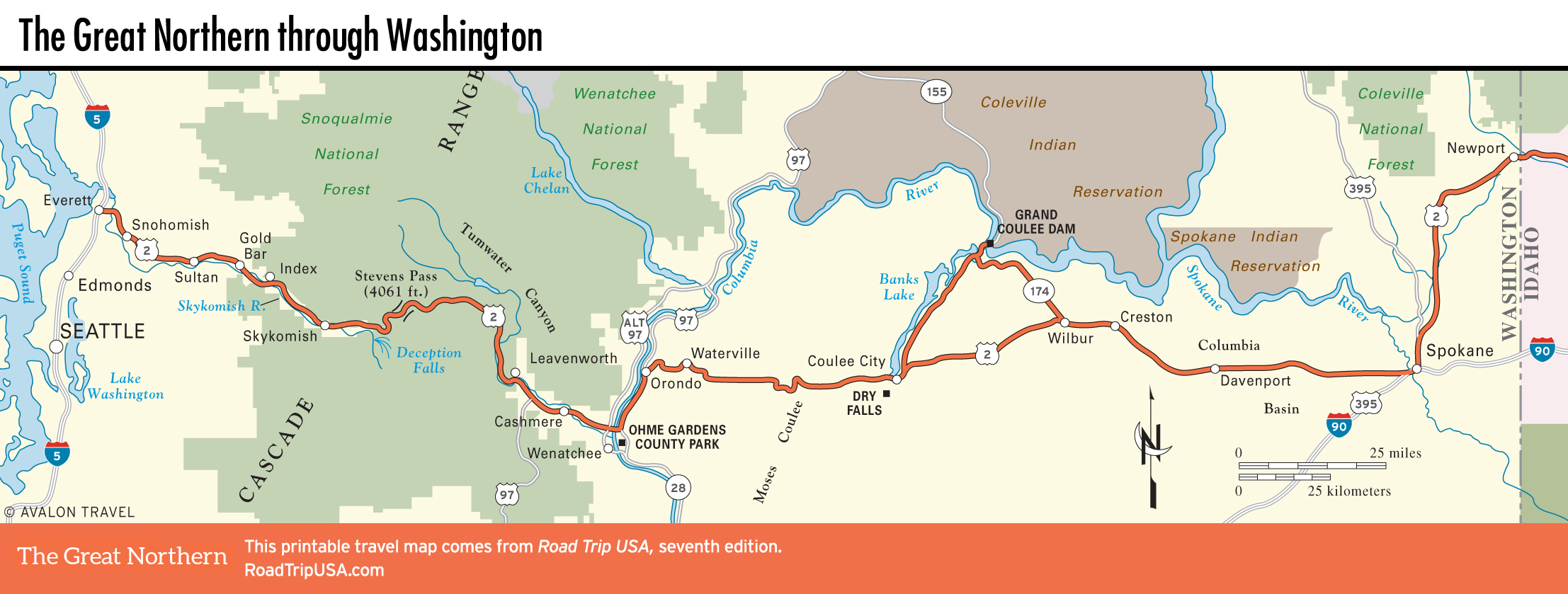
The Columbia Basin: Wilbur and Davenport
The 150-mi (242-km) stretch of rolling farmland that lies to the east of the Cascades is a natural desert, receiving an average of 22 inches of annual rainfall. Alhough small-scale farming limped along here for over a century, the region underwent a wholesale change after World War II, when irrigation water from reclamation projects along the Columbia River and its many tributaries turned the sagebrush plains into the proverbial amber waves of grain, spreading toward the horizon against an (almost) always-clear blue sky.
US-2 runs directly across the heart of this sparsely populated, nearly treeless region, passing through a few small towns. In Wilbur, at the turnoff to Coulee Dam, an old service station has been brought back to life as a drive-by espresso stand, and Billy Burgers (804 SE Main St., 509/647-5651) has good food and great milkshakes, right on US-2. East of Wilbur 8 mi (12.8 km) is the blink-and-you’ll-miss-it community of Creston (“Home of 1982 and 1984 Girls State B Champions”), where daily life revolves around the Corner Café at the center of town.
Davenport, one of the oldest towns in eastern Washington, 20 mi (32 km) east of Creston, has a nifty old courthouse on a hill just north of US-2, a handful of quaint old houses, and the small Lincoln County Historical Museum (509/725-6711), located a block south of US-2 at Park and 7th Streets. Davenport also boasts a burger-and-shake place along US-2 at the east end of town.
Related Travel Maps
Related Travel Guides