Fort Peck Area
Fort Peck and Fort Peck Dam
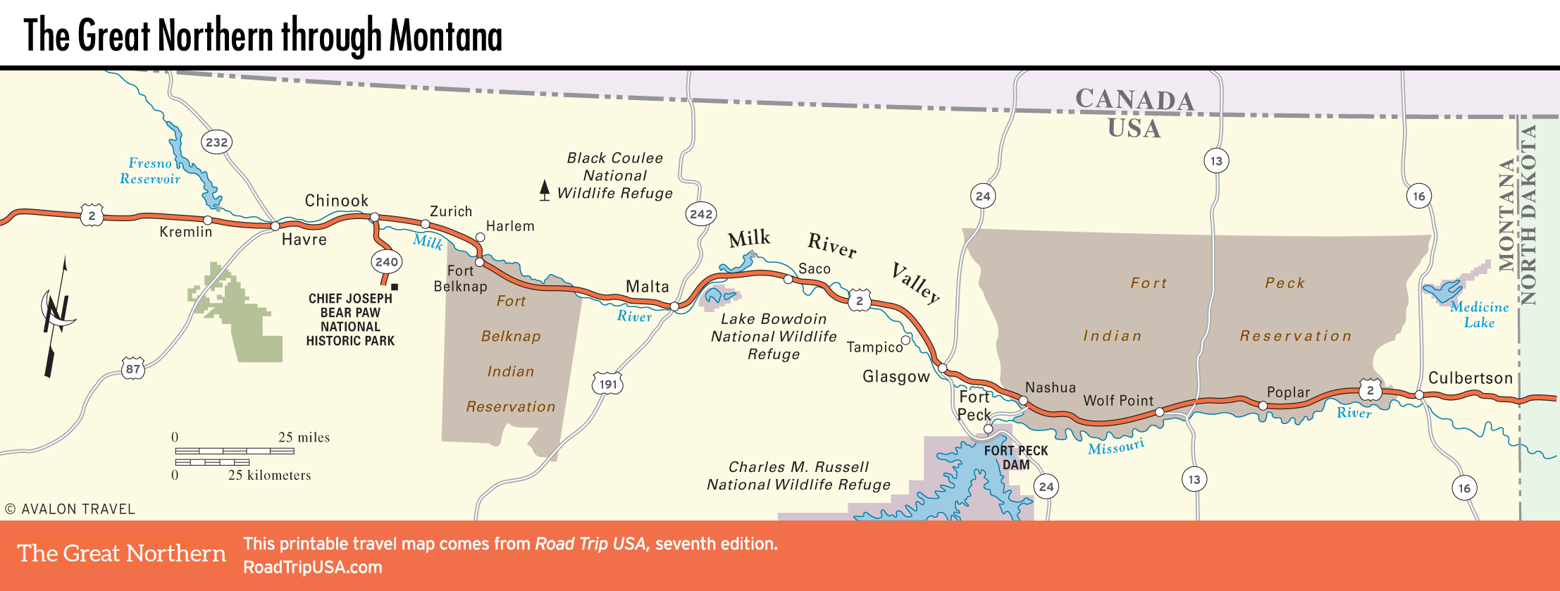
Enormous Fort Peck Lake, 19 mi (31 km) south of Glasgow and US-2 via Hwy-24, collects the waters of the Missouri River behind massive Fort Peck Dam, one of the largest construction projects of the New Deal era and still the world’s second-largest earthen dam. From 1933 until 1940, a friendly invasion of ultimately 10,000 civilian workers, earning between $0.50 and $1.20 per hour, hacked, dug, poured, sweat, and wrested a sea out of High Plains desolation. As a result, 20 million acre-feet of water can be impounded behind the nearly 4-mi-long (6.4 km) dam, corralled to a maximum depth of 220 feet (67 meters) and with a serpentine shoreline longer than California’s! Ongoing drought since 1998 means levels are well below average, hurting recreation and leaving boat ramps high and dry; the lake is also home to a huge array of wildlife, including elk, bighorn sheep, pronghorn, and migrating waterfowl, all protected within the Charles M. Russell National Wildlife Refuge. The Fort Peck area also has one of the world’s biggest concentrations of fossils; dinosaur bones, including skulls of a triceratops and a T. rex, can be seen inside the Fort Peck Dam Interpretive Center and Museum (406/526-3493, daily summer, free), at the base of the dam. Fort Peck Lake is most easily approached via Hwy-117, driving 15 mi (24 km) south from US-2 at the town of Nashua; you can also reach it from Glasgow via Hwy-24.
Besides the dam and the lake, the area’s best surviving example of New Deal spirit is the snug town of Fort Peck (pop. 241), built from scratch to house the construction workers, though its current population is but a small fraction of the number that once called it home. In the premier issue of Life magazine (November 23, 1936), documentary photographer Margaret Bourke-White profiled the town of Fort Peck as well as the other 18 boomtowns that sprang up in the surrounding area during construction of Fort Peck Dam. A few of the old buildings still stand, including the landmark Fort Peck Theatre (406/526-9943) on Hwy-24, a huge draw in the area with its summertime plays and musicals. One of the greatest places to stay near US-2 in Montana is the original Fort Peck Hotel (175 S. Missouri St., 406/526-3266 or 800/560-4931, June-Nov.), long dormant but recently taken over and touchingly (with nary an ounce of avarice) brought back into a semblance of its classic old self. Rates are reasonable ($75 and up), and the restaurant is by far the best in the area.
Fort Peck Indian Reservation
The sprawling Fort Peck Indian Reservation, Montana’s second largest, stretches for nearly 100 mi (161 km) along US-2, and for 50 mi (81 km) north. Although it is home to 6,800 Assiniboine and Yanktonai Sioux people, it is mostly owned by nonnatives as a result of unscrupulous land dealings encouraged by the 1887 Dawes Act. Wolf Point, the reservation’s largest town (and location of the only Amtrak station for miles!), is also the site of the Montana Cowboy Hall of Fame & Western Heritage Center (218 3rd Ave. S., 406/653-3800) and home to cafés and taverns like the Missouri Breaks Brewing Company (326 Main St., 406/653-1467), where you can get a range of fresh-brewed micro beers. There are a few motels, including Sherman Inn (200 E. Main St., 406/653-1100, $89 and up), which has clean rooms and a decent restaurant.
Another 55 mi (89 km) east of Wolf Point down US-2, nearly at the North Dakota border, Culbertson (pop. 795) is a quiet town with a disproportionate number of farm-implement and feed dealers. Located a mile (1.6 km) east of town, the Montana Visitor Center (406/787-6320) houses a good local history museum.
Related Travel Guides