Algonquin Provincial Park to Pembroke
Algonquin Provincial Park
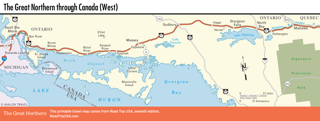
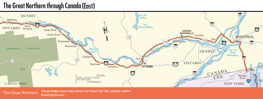
Between Mattawa and Deep River, Hwy-17 runs along the northern boundaries of the enormous Algonquin Provincial Park, which stretches for many miles to the south. Ontario’s oldest and most popular park, Algonquin protects 2,955 square miles (7,653 square km) of almost untouched wilderness, offering a wide variety of wildlife (including moose, bears, beavers, and timber wolves), dozens of lakes, and hundreds of miles of backcountry hiking and canoeing trails. The main visitors center (705/633-5572) is at the park’s far southwest corner, south of North Bay or west of Pembroke and Renfrew via Hwy-60, the Parkway Corridor, the only road through the park. Here you can get details on the park’s abundant camping and cabins and pick up all the necessary permits.
Deep River and Chalk River
The first real town east of Mattawa is Deep River (pop. 4,494), Canada’s first “Atomic Town,” a planned community built for employees of the Chalk River labs just downstream.
The tiny logging center of Chalk River, 6 mi (10.5 km) father east, has been the home of the first atomic reactor outside of the United States since 1945. Seven years later, Atomic Energy of Canada, Ltd. (AECL), a government-owned nuclear research organization, was founded here. It designs and sells commercial and research nuclear reactors around the world and produces most of the world’s radioactive isotopes for medical use. In recent years, problems at the Chalk River plant, due to leaks, seismic improvements, and deferred maintenance, caused a serious worldwide shortage of these vital medical products, putting the Chalk River labs in the media spotlight.
Petawawa and Pembroke
Southeast of Chalk River, Hwy-17 crosses the namesake river of the town of Petawawa, home since 1905 to a Canadian Forces base. You can visit the small military museums on the base, including the Garrison Petawawa Military Museums. One exhibit, the Canadian Airborne Forces Collection, traces the history of Canadian paratroopers. There’s also a riverfront beach and campground, but otherwise the area is strictly off-limits, as the numerous signs along the road warn.
The rather quaint, redbrick town of Petawawa itself is 2 mi (3.2 km) east of Hwy-17 via Hwy-41, well worth the short trip through what seems like one big light-industrial park.
Wrapping around the eastern edge of Algonquin Provincial Park, Hwy-17 nears Pembroke, another timber town along the Ottawa River, north of the highway. The main sights here are the more than 30 history-themed murals painted on downtown buildings; the Champlain Trail Museum (1032 E. Pembroke St., May-Sept., C$8), with exhibits on local history; and the friendly ambience and awesome food at the Nook Crêperie Inc. (26 W. Pembroke St. W, 613/735-4800), right downtown.
Related Travel Maps


