Canada
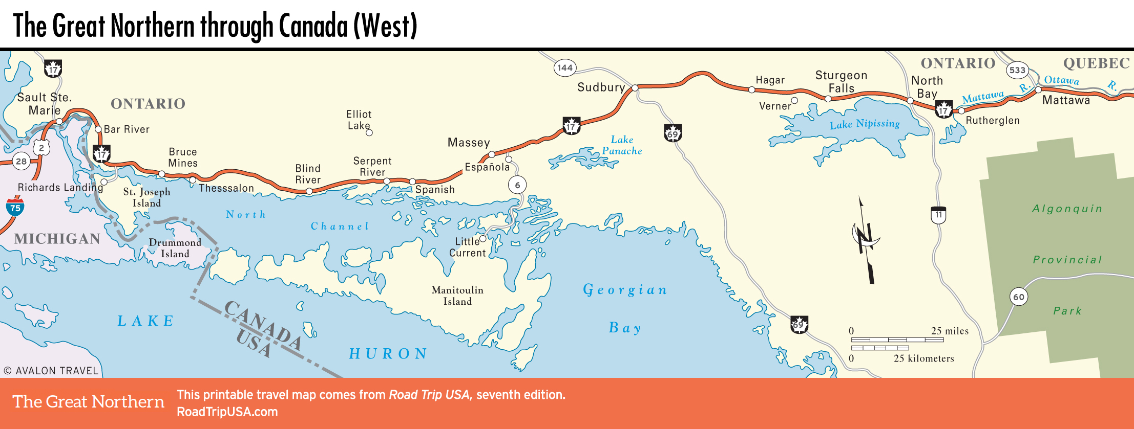
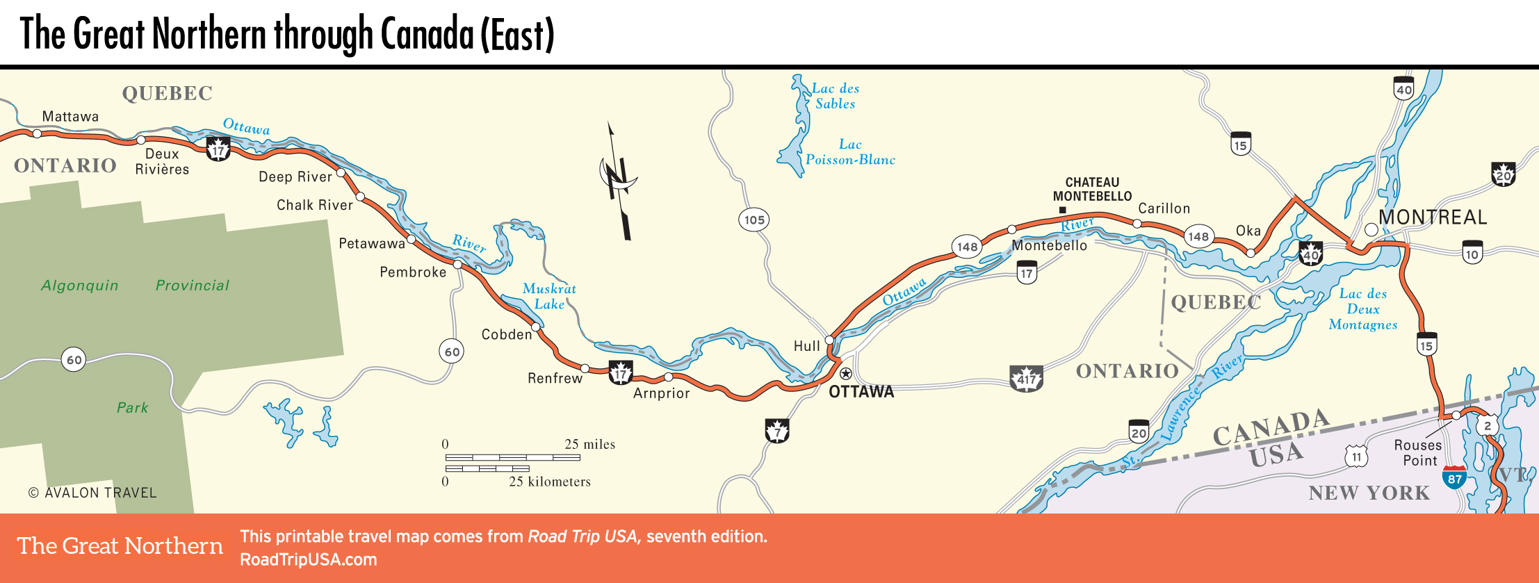
Between Sault Ste. Marie and Ottawa, the capital of Canada, our route winds along the north shore of Lake Huron, then cuts inland to follow a series of broad rivers. The main highway here, Hwy-17, is a section of the busy Trans-Canada Highway. It is also part of the Voyageurs Trail, roughly retracing the route taken by the early fur traders between their winter trapping grounds—the wilderness of forests, lakes, and streams to the northwest—and Montreal, the summer fur market.
The scenery varies from rivers and forests to paper mills and coal mines, and most of the way Hwy-17 is a two-lane road with a 89-km/h (55-mph) maximum and occasional passing lanes to help you get around the timber trucks. Towns here tend to sprawl along the roadside, with a few “chip stands,” selling fried potatoes, among the familiar franchised fast-food joints, but there are expansive sections of natural wilderness within easy reach.
East of Ottawa, it’s a short run to French-speaking Montreal, Canada’s second-largest city and one of the most European places in North America. The change between bilingual Ontario and French-speaking Quebec is sudden and sometimes surreal, as if England and France were divided by a river, not the English Channel.
Related Travel Maps
Related Travel Guides