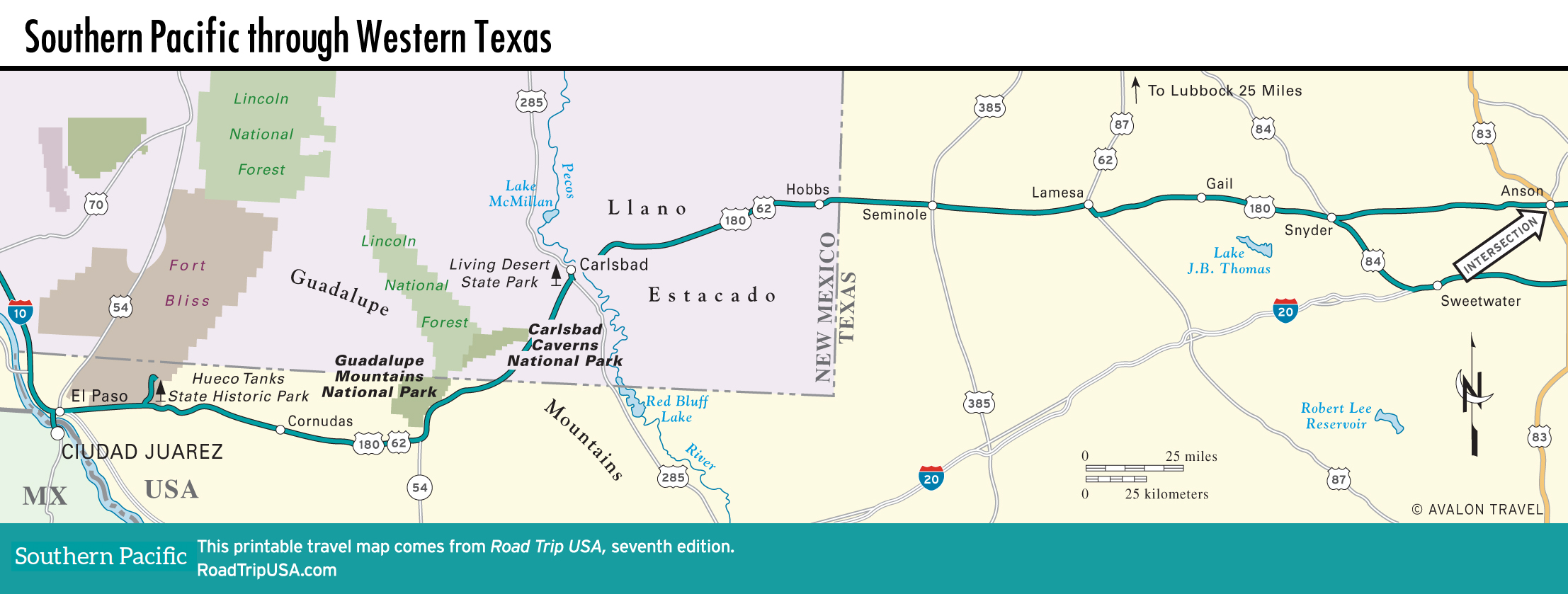
Carlsbad and the Llano Estacado
Carlsbad
Northeast of the turnoff to Carlsbad Caverns, about 20 mi (32 km) or so, the town of Carlsbad (pop. 29,331) makes its living from the 465,000 tourists who visit the caves every year. Lining Canal Street (a.k.a. US-180, the National Parks Highway), the main road through Carlsbad, you’ll find most national motel chains along with funkier local counterparts. There’s also one good Mexican-American restaurant, the Pecos River Café (409 S. Canal St., 575/887-8882), where locals come for early-morning short-order breakfasts and lunchtime enchiladas.
Apart from the caverns, the one other wonderful thing to see in the Carlsbad area is the Living Desert Zoo and Gardens State Park (575/887-5516, daily, $5), 5 mi (8 km) northwest along US-285, which shows off the plant and animal life of the arid Chihuahuan Desert region. Foxes, wolves, hawks, and eagles are kept in re-creations of their natural environments and can be seen along a 1.3-mi (2-km) nature trail.
US-180: The Llano Estacado
From Carlsbad, US-180 crosses the Pecos River, then snakes across the barren Llano Estacado (Staked Plains), which covers most of eastern New Mexico and the Texas Panhandle. Supposedly named by early explorers who drove wooden stakes into the ground to mark their way, the Llano Estacado area is pretty much the same on both sides of the border—flat, dry, and mostly devoid of settlement. For eastbound travelers, this is the place where oil first becomes noticeably important. Pump jacks can be seen pumping away from here all the way to Alabama.
This is also cowboy country, thanks to the extensive pastures irrigated by water pumped up from aquifers deep underground. For travelers, however, the dominant image is of land stretching out far and wide: mile after mile after mile of endless flat cotton fields, interrupted every now and then by brilliant green alfalfa fields and a few surprisingly large towns, like Hobbs (pop. 38,277), New Mexico. Right on the border, Hobbs’s main street is lined with drilling supply and hydraulic fracturing (“fracking”) companies, as well as front yards filled by huge piles of steel pipe. Because the plains get a huge amount of summer sunshine, which generates a lot of thermal lift, this part of the world is also ideal for gliding, which may be why the Soaring Society of America (575/392-1177) is located here.
The Texas part of the drive is dotted with towns like Lamesa (pop. 9,042; pronounced “la-MEE-sa”), which, after the miles of open red-earth prairie around it, can seem like a bustling hive of activity. Lamesa also has all the all-American makings of a location from the high-school-football TV show Friday Night Lights, which was inspired by real-life Odessa, Texas, an hour to the southwest. Sports-mad families enjoy the old Dairy Queen drive-in (512 N. 4th St., 806/872-8155), right on the main drag.
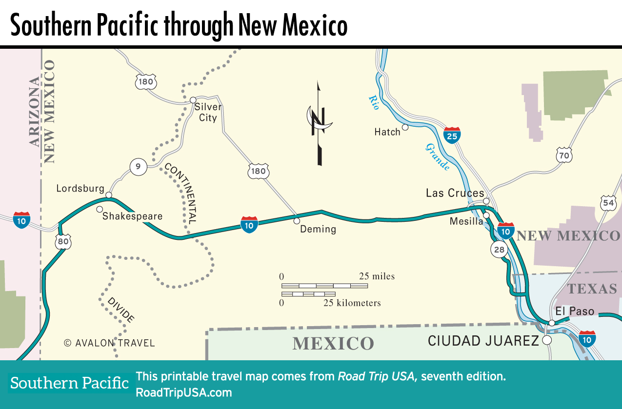
Maps of the Southern Pacific Route through New Mexico and Texas
Related Travel Guides