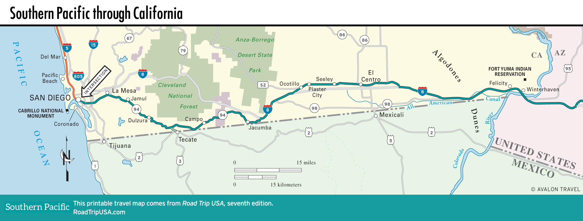
Point Loma to Campo
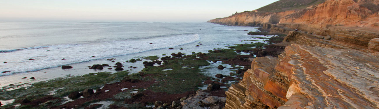
Point Loma: Cabrillo National Monument
The sturdy headland that protects San Diego’s extensive harbor from the open Pacific Ocean, Point Loma has long been occupied by the military, whose many fences, radio towers, and gun emplacements all seem to disappear at the tip, where the Cabrillo National Monument (619/557-5450, 9am-5pm daily, $20 per car) protects a breathtaking 160 ac (65 ha) of cliffs and tide pools. It was set aside in 1913 to remember the efforts of conquistador Juan Rodríguez Cabrillo, who explored the California coast in 1542, sailing under a Spanish flag. There’s also an old lighthouse, some nice trails, and a visitor center describing the whole shebang.
Across San Diego: Old US-80
From Point Loma and the Pacific Ocean, old US-80 bends south past the San Diego International Airport (sometimes referred to as Lindbergh Field, named for Charles Lindbergh and featuring one of the most hair-raising landing patterns of any big American airport) and through downtown along 12th Avenue and Market Street. Old US-80 then veers north again along the Cabrillo Freeway (one of the oldest in the country) through historic Balboa Park, home to the San Diego Zoo, a replica of London’s Old Globe Theater, and many grand Spanish colonial buildings that have been standing here since the 1915 Panama-California Exposition.
East of San Diego, old US-80 follows El Cajon Boulevard past San Diego State University and a dozen miles (19.3 km) of old motels, cafés, and gas stations before it reaches the foothill town of La Mesa, where you can leave old US-80 (which runs alongside the high-speed I-8 freeway) and turn onto the two-lane blacktop of Hwy-94. Twisting to the southeast around the 4,000-ft (1,219-m) peaks of this part of the Cleveland National Forest, Hwy-94 traverses classic Southern California landscape: rolling, chaparral-covered hillsides rising above grassy ranch lands and stately valley oaks.
Tecate, Mexico
After passing through Jamul and Dulzura, two quiet ranching towns that appear on the verge of extinction due to San Diego’s rapidly approaching sprawl, some 40 mi (64 km) east of downtown San Diego along Hwy-94, you’ll spot a sign marking the turnoff south to the Mexican border town of Tecate (pop. 72,860). Known around the world as the source of tangy Tecate beer—by most accounts, the brew that started people drinking beer with a squeeze of fresh lime—Tecate is in the top tier of enjoyable border towns, if only by virtue of being cleaner, quieter, safer, and much less “touristy” than Tijuana. Potential stops include a nice park, four blocks south of the border; the usual restaurants, cantinas, and souvenir shops; plus two special stops: the idyllic and rejuvenating Rancho la Puerta spa resort (858/764-5500 or 800/443-7565), and the historic Tecate Brewery (+52-665/654-9490, Tues.-Sun.). The brewery, now part of the Dutch megabrewer Heineken, offers free tours by appointment; call ahead for a reservation.
Because of insurance concerns and Homeland Security hassles, it’s a good idea to leave your car on the U.S. side of the border and cross into Mexico on foot, passport in hand. East of the Tecate area, Hwy-94 runs along the U.S. side of the border for 41 mi (66 km) before joining the I-8 freeway.
Campo
Set in a broad valley midway between Tecate and the I-8 freeway, tiny Campo (pop. 2,684) has one main attraction, the Pacific Southwest Railway Museum (619/478-9937, 9am-5pm Sat.-Sun. and holidays, $10 adults, $5 children), at the west end of town on Depot Street. Along with an extensive outdoor collection of old locomotives and carriages, the museum offers train rides (times vary, $15 adults, $5 children) on restored steam- and diesel-powered trains, including a 12-mi (19.3 km) round-trip through the surrounding countryside. Campo also marks the southern end of the Pacific Crest Trail, which winds for 2,650 or so miles (4,265 km) between Canada and Mexico.
Map of the Southern Pacific Route through California
Related Travel Guides