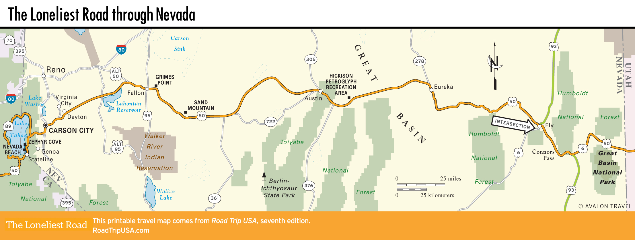
Ely
Ely
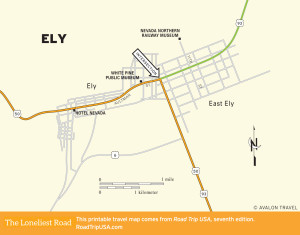
After the main mines closed down in 1982, the railroad that had shuttled pay dirt from the mines to the smelter was abandoned—track, stock, and depot. In 1985 the entire railroad operation was turned into Nevada Northern Railway Museum (775/289-2085, daily), and now you can take a 90-minute train ride (around $33), pulled by a 1910 Baldwin Steamer locomotive. The train leaves from the depot at the north end of East 11th Street and uses a ton of coal and 1,000 gallons of water.
Ely’s other main stop is the White Pine Public Museum (2000 E. Aultman St./US-50, 775/289-4710, seasonal hours, $5), which has a wide-ranging collection of minerals, mining implements, and Pony Express memorabilia on display.
Along with extensive mining history, Ely has motels, gas stations, the only supermarket for the next 150-some mi (242 km) east, and dozens of vivid, building-size murals depicting various aspects of the town’s heritage. The heart of town is a neon-rich few blocks of Aultman Street (US-50) west of the US-93 junction, centering on the landmark Hotel Nevada (775/289-6665 or 888/406-3055, $69 and up), with its giant miner and neon-lit slot machines. Inside there are real (as opposed to video) slot machines, pool tables, a café, and a bar. For a bit more peace and quiet, try Jailhouse Motel (211 5th St., 775/289-3033, $74 and up), a block north of Aultman Street.
For food, Ely has three coffee shops along US-50, plus the chance to down a milkshake at the soda fountain inside Economy Drug (775/289-4929), at Aultman and 7th Streets.
The route east of Ely toward Great Basin National Park is an official “scenic route,” rolling across sagebrush plains and climbing over the Schell Creek and Snake Mountain ranges through dense groves of pine and juniper.
Connors Pass and Majors Place
East of Ely, US-50, spliced together with US-6 and US-93 into a single two-lane highway, continues for 22 mi (35 km) before crossing the narrow waist of the Schell Creek Range at 7,729-ft (2,356-m) Connors Pass. As you ascend toward the pass, the air cools and freshens, while the single-leaf piñon and Utah juniper appear and increase. As you crest the summit, the mighty Snake Range, including 13,063-ft (3,982-m) Wheeler Peak, comes into view.
East of the pass, at Majors Place (where there’s a roadhouse with cold beer and “loose slots” but no reliable gas), US-93 cuts due south, heading 80 long solitary mi (129 km) to the next contact with humans at Pioche, while US-50 heads east across open rangelands toward Great Basin National Park.
Related Travel Guides