Old Route 66: Devil’s Elbow
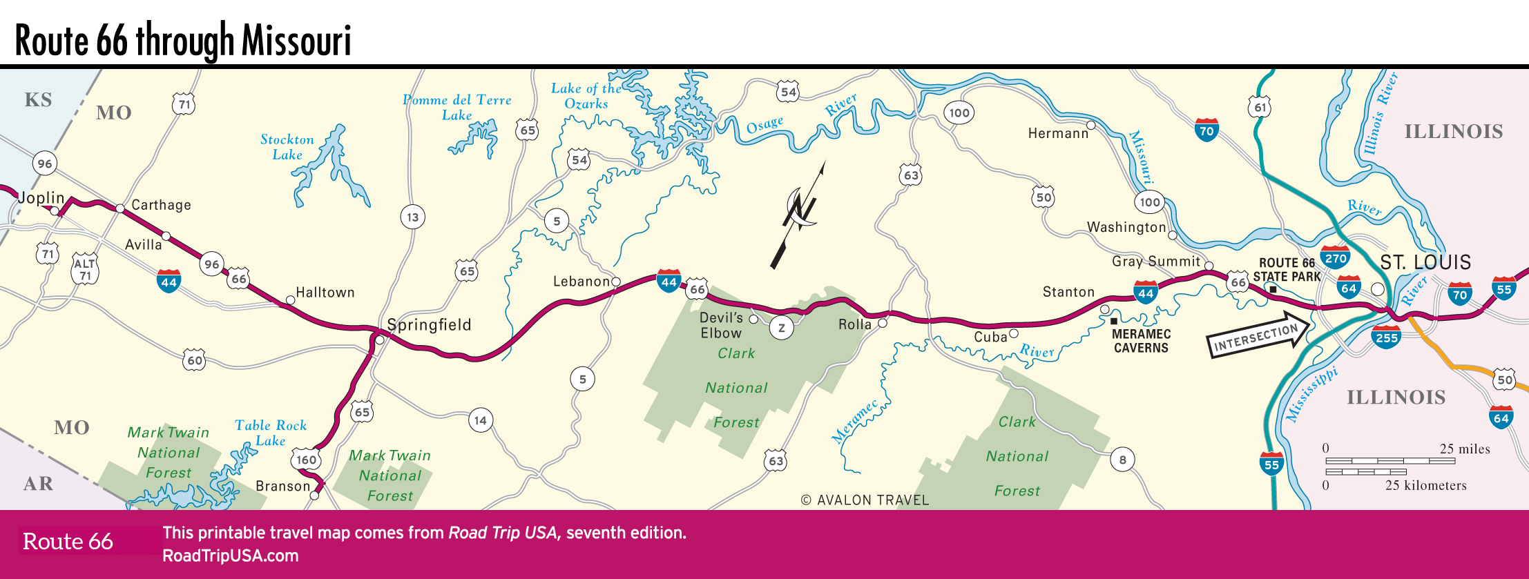
West of Rolla toward Springfield, I-44 has been built right on top of the old Route 66 corridor. Dozens of mostly abandoned old motels, motor courts, gas stations, and other highway-dependent businesses line the remains of the old road, which still serves as a freeway frontage road for most of the way. There are plenty of antiques shops and cafés to make detours interesting, and the longish detour along old Route 66 through the Devil’s Elbow district is especially memorable. But if you’re pressed for time, even the interstate superslab offers a plenty-scenic drive through these upland Ozark Mountains, much of which are protected from development within the Mark Twain National Forest.
This is the most ruggedly picturesque stretch of Route 66 across Missouri; the name “Devil’s Elbow” comes from a section of the Big Piney River that turns so acutely it caused repeated logjams. The earliest incarnations of Route 66 followed what’s now signed as “Teardrop Road,” and up until 1981 the last alignment of Route 66 followed what’s now the hilly, four-lane Hwy-Z, some of the last Missouri sections of the old road to be bypassed by I-44 (all this is between I-44 exits 163 and 169).
Besides the old road itself, a great reason to tour this 10-mi (16.1-km) stretch of old Route 66 is the chance to sample some fine pulled pork at the Sweetwater BBQ (573/336-8830), on Hwy-Z just southeast of I-44 exit 163.
West of here, the scenic old road crashes suddenly back into the franchised fast food of I-44 at the twin towns of St. Robert and Waynesville, where 80,000-plus soldiers and civilians train at the nearby Fort Leonard Wood U.S. Army base, headquarters of the U.S. Army military police school (and a small museum), have generated a rash of Walmarts and shopping malls.
Missouri Travel Map
Related Travel Guides