Neah Bay and Cape Flattery
Driving to Cape Flattery
The Strait of Juan de Fuca, the narrow inlet that links the open Pacific with Puget Sound and divides the United States from Canada, was named for the Greek sailor (real name: Apóstolos Valerianos) who first mapped it while working for the Spanish Crown in 1592. On a clear day, you can get some great views across the strait from Hwy-112, which runs along the shore from US-101 all the way to the tip of the Olympic Peninsula at Neah Bay. Though it looks like a great drive on the map, Hwy-112 is a narrow and winding road with some surprisingly steep hills and thick woods that block much of the view, all of which, in addition to the plentiful logging trucks, can make it less than ideal for bicycling or even a scenic drive.
Travel Map of Washington’s Olympic National Park
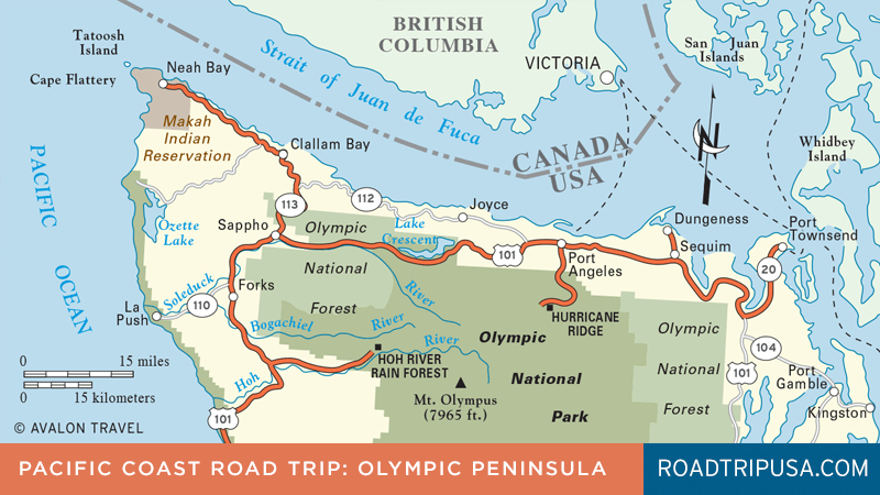
From the crossroads at Sappho on US-101, Hwy-113 leads north, linking up with Hwy-112 on a long and winding 44-mile detour through Clallam Bay to Cape Flattery, the northwesternmost tip of the continental United States. The highway is paved as far as the town of Neah Bay (pop. 865), a tiny community that’s the center of the Makah Indian Reservation.
Salmon and halibut fishing, both by Makah and by visitors, is about the only activity here, though the community does have the impressive and modern Makah Museum (360/645-2711, daily, $6), one of the best anthropological museums in the state. Most of the displays are of artifacts uncovered in 1970, when a winter storm exposed the pristine remains of a 500-year-old coastal village that had been buried in a mudslide—the Pompeii of the Pacific Northwest. Other galleries display finely crafted baskets, a full-scale longhouse complete with recorded chants, and a whaling canoe from which fearless Makah harpooners would jump into the surf and sew up the jaws of dying whales to keep them from sinking. The museum gift shop displays and sells a variety of high-quality arts and crafts made by Makah people. For fascinating insights into Makah worldviews, check out Robert Sullivan’s thought-provoking book A Whale Hunt: How a Native-American Village Did What No One Thought It Could.
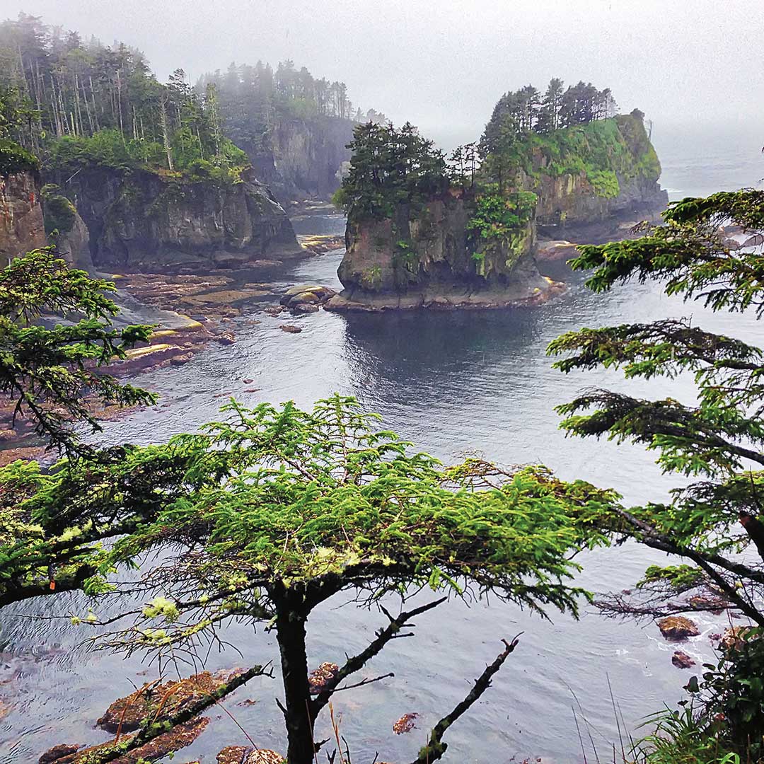
The Hwy-112/113 route twists along the rocky and wooded shore of the Strait of Juan de Fuca, but reaching the actual cape itself isn’t difficult. From Neah Bay, the well-maintained western half of the Cape Loop Road winds along the Pacific to a parking area that gives access to a trail that brings you to the top of a cliff overlooking the crashing surf and offshore Tatoosh Island. On a sunny day it’s a gorgeous vista, but if the weather’s less than perfect (which it often is), your time would be much better spent inside the Makah Museum.
Related Travel Guides