Washington
The coast of Washington is a virtual microcosm of the Pacific Northwest, containing everything from extensive wilderness areas to Native American fishing villages and heavily industrialized lumber towns.
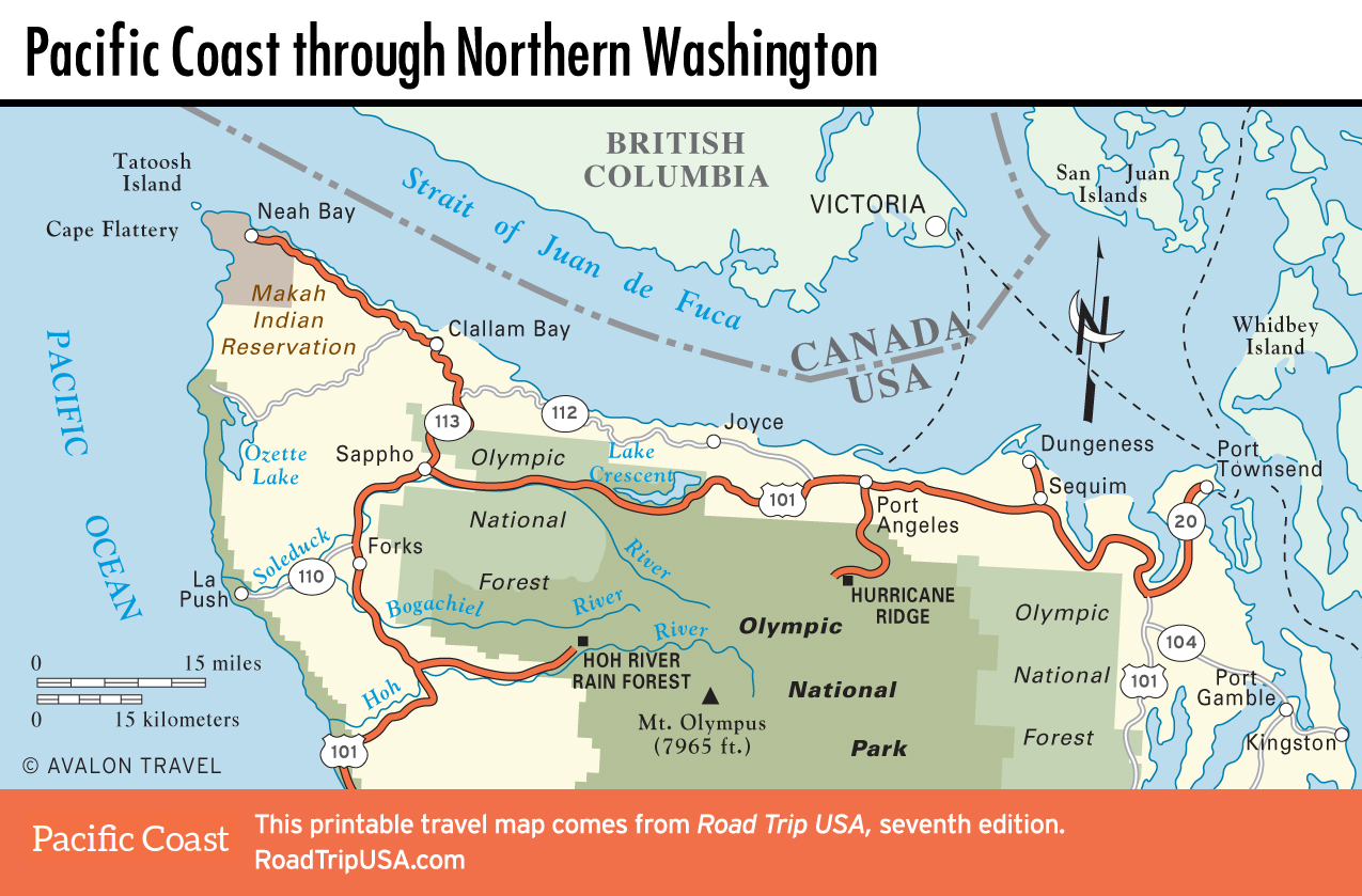
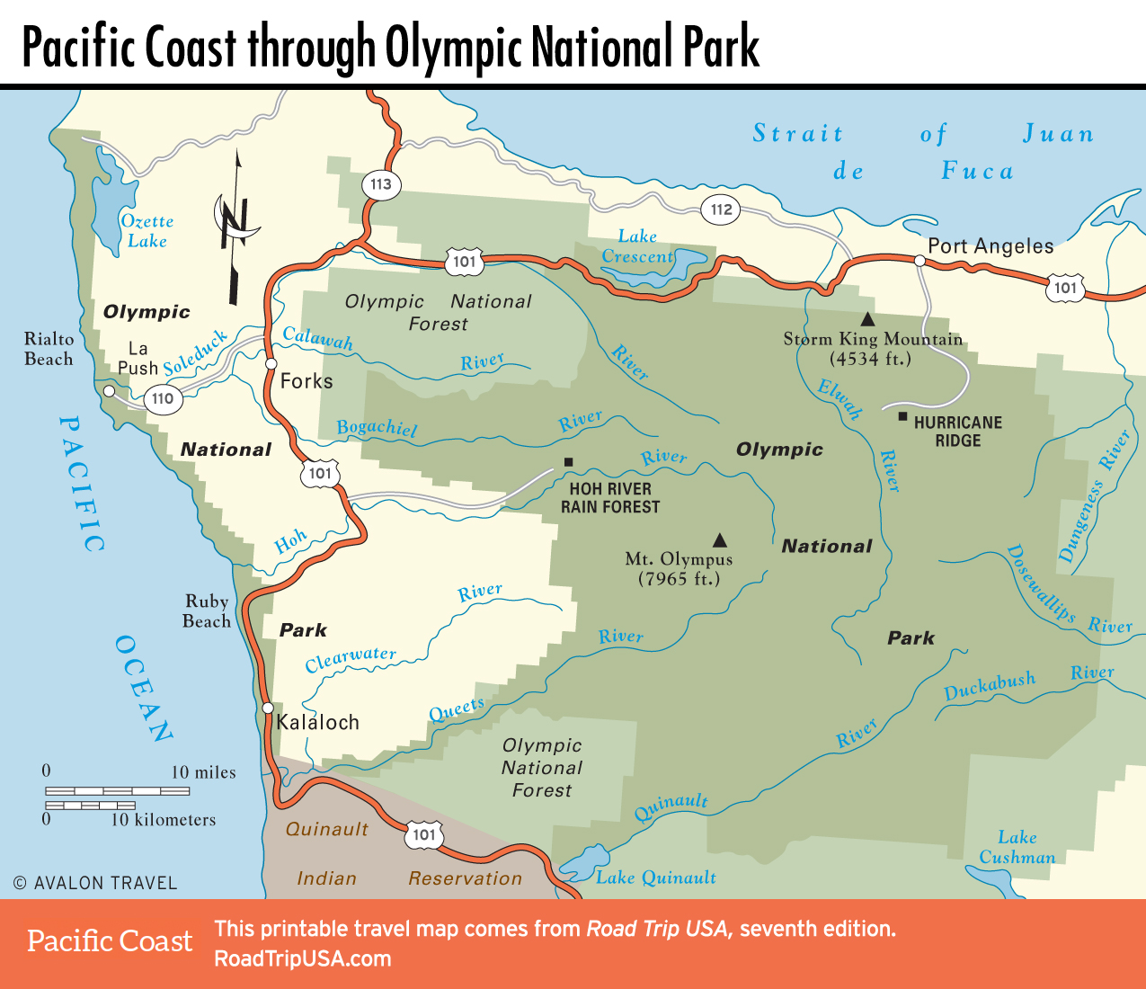
Starting at splendid Port Townsend, US‑101 loops west around the rugged Olympic Peninsula, passing near the northwesternmost point of the continental United States while allowing access to the unforgettable natural attractions—sandy, driftwood-strewn beaches; primeval old-growth forests; and pristine mountain lakes and glaciated alpine peaks, to name just a few—of Olympic National Park.
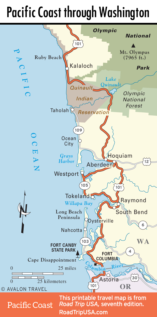
The roadside landscape varies from dense woods to clear-cut tracts of recently harvested timber. Innumerable rivers and streams are perhaps the most obvious signs of the immense amount of rainfall (about 12 feet) the region receives every year. Scattered towns, from Port Angeles in the north to the twin cities of Grays Harbor on the coast, are staunchly blue-collar communities almost wholly dependent upon natural resources—not only trees, but also salmon, oysters, and other seafood. Though the tourism trade has been increasing steadily, visitor services are still few and far between, so plan ahead.
Though it’s not on the ocean, the Puget Sound port city of Seattle makes a good starting or finishing point to this Pacific Coast road trip.
Maps of the Pacific Coast Route through Washington
![[object Object]](https://content.roadtripusa.com/wp-content/uploads/2021/03/9781640499980.webp)
![[object Object]](https://content.roadtripusa.com/wp-content/uploads/2021/03/9798886470680.webp)
![[object Object]](https://content.roadtripusa.com/wp-content/uploads/2020/06/Moon-Oregon-1e-Jacket-scaled.jpeg)