Point Arena to Fort Ross
Point Arena and Gualala
With only a few exceptions, the southernmost 40 miles of Mendocino coastline are almost totally undeveloped and virtually uninhabited, with green forests and coastal coves as far as the eye can see. The westernmost point here, Point Arena, is about five miles northwest of Hwy-1 via Lighthouse Road (the namesake lighthouse, built in 1870, stands 115 feet tall). Back on Hwy-1, the small town of Point Arena is worth a wander for nice cafés and bakeries; try the fluffy quiches or buttery croissants at the très Francophile Franny’s Cup & Saucer (213 Main St., 707/882-2500), across the street from the lively Arena Theater, which puts on new-run movies nightly and good live music.
Another 15 miles south, situated at the southern edge of Mendocino County, the old logging port of Gualala (pop. 2,093) has one truly remarkable feature: the Russian Orthodox domes of St. Orres (36601 S. Hwy-1, 707/884-3303), now a B&B inn and $50-plus per person gourmet restaurant glowing with polished wood and stained glass, above Hwy-1 on the north side of town.
If you prefer to hang out with locals rather than well-heeled tourists from San Francisco, head instead to local bakeries like Trinks Café (707/884-1713) in the Seacliff Center shopping complex. Great camping and an incredible coastal panorama can be yours at Gualala Point Regional Park (707/785-2377, $7 per car, $32-35 camping), a mile south of town along the Gualala River.
Sea Ranch
Midway between Mendocino and the San Francisco Bay Area, the vacation-home community of Sea Ranch was laid out in the mid-1960s by a visionary group of architects and planners, including Lawrence Halprin and Charles Moore, who hoped to show that development need not destroy or negatively impact the natural beauty of the California coast. Strict design guidelines, preserving over half the 5,000 acres as open space and requiring the use of muted natural wood cladding and other barn-like features, made it an aesthetic success.
The rest of Sea Ranch, however, is strictly private, which has raised the hackles of area activists, who after years of lawsuits finally forced through a few coastal access trails in the mid-1980s; these, such as Walk-On Beach at milepost 56.5, are marked by turnouts along Hwy-1.
Salt Point State Park
The many sheltered rocky coves of Salt Point State Park make it ideal for undersea divers, who come to hunt the abundant abalone. Along these six miles of jagged shoreline, pines and redwoods clutch the water’s edge, covering some 6,000 acres on both sides of Hwy-1 to make Salt Point a prime place for hiking and camping. For a guide to the 20 miles of trails, or background on the sandstone mortars and other remnants of the Kashaya Pomo Native American village that stood here until the 1850s, contact the visitors center (707/847-3221).
One of the few positive effects of cutting down the native redwood forests that once covered the Northern California coast has been the emergence of giant rhododendrons in their place. You’ll find the most impressive display at the Kruse Rhododendron State Natural Reserve, high above Hwy-1 adjacent to Salt Point State Park, where some 300 acres of rhododendrons, some reaching 14 feet in height, burst forth in late spring, usually peaking around the first week of May.
In between Salt Point and Fort Ross, Beniamino Bufano’s 93-foot Peace statue looms like a shiny silver missile alongside Hwy-1 above craggy Timber Cove, where there’s also a nice restaurant and inn at the Timber Cove Resort (707/847-3231, $230 and up).
Fort Ross State Historic Park
If you’re captivated by California’s lively history, one of the most evocative spots in the state is Fort Ross State Historic Park, the well-restored remains of a Russian fur-trapping outpost built here in 1812. During a 30-year residency, the Russians farmed wheat and potatoes, traded with Native Americans, and trapped local seals and sea otters for their furs, which commanded huge sums on the European market.
By 1840, the near destruction of the sea otter population caused the company to shut down operations and sell the fort to Sacramento’s John Sutter, who financed the purchase on credit. Later, the abandoned fort was badly damaged by the 1906 San Francisco earthquake and later fires, but the state has completed a high-quality restoration and reconstruction project, using hand-hewn lumber and historically accurate building methods to replicate the original barracks and other buildings, including a luminous redwood chapel.
From Hwy-1, Fort Ross spreads west, 20 miles south of Sea Ranch and a dozen miles north of the Russian River. Outside the fort’s walls, a modern visitor center (707/847-3286, daily summer, Mon.-Fri. winter, $8 per car) traces the site’s natural, Native American, and Russian history, and offers information on the park’s many fine hiking trails.
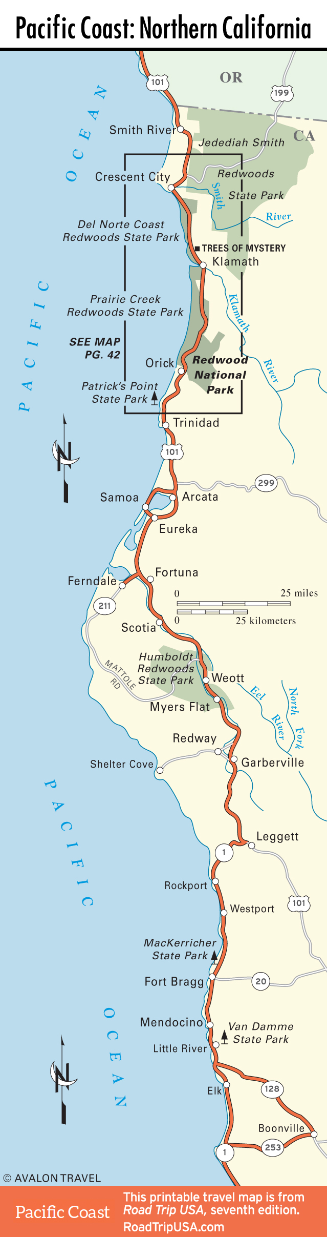
Northern California Travel Map
Related Travel Guides