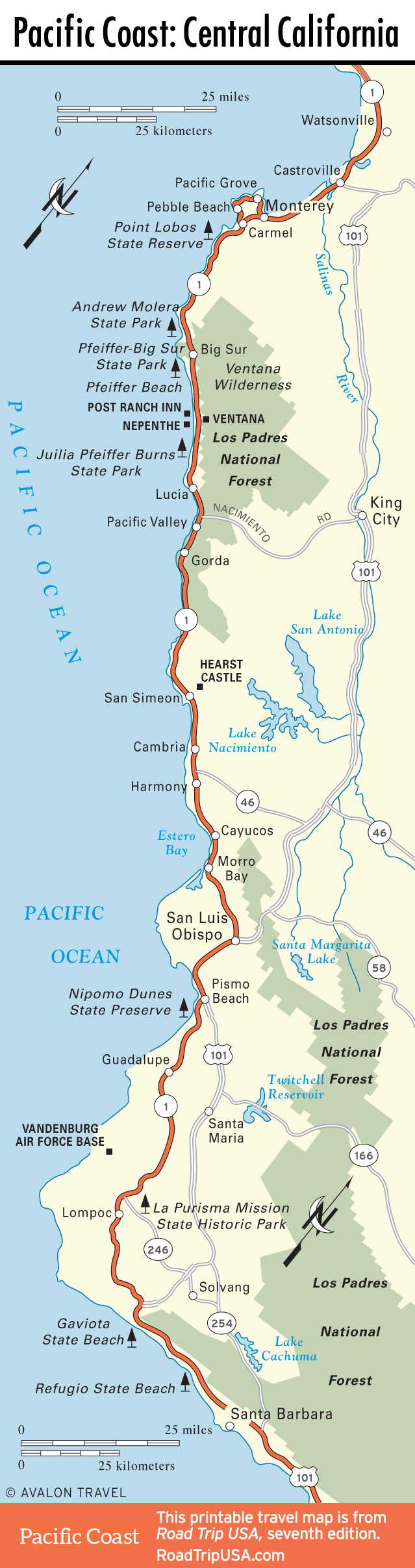
Nacimiento-Fergusson Road and Mission San Antonio de Padua
The narrow Nacimiento-Fergusson Road, five miles south of Lucia, makes an unforgettable climb up from Hwy-1 over the coastal mountains. Though ravaged in places by wildfires, it’s a beautiful drive, winding through hillside chaparral and dense oak groves before ending up near King City in the Salinas Valley. One real highlight here is Mission San Antonio de Padua (831/385-4478, ext. 17, daily 10am-4pm, call to confirm hours), a well-preserved church and monastery that is still in use by a Roman Catholic religious community. Because the road passes through sections of Fort Hunter Liggett Army Base, you may need to show valid car registration and proof of insurance. History note: All the land on which the army base and mission stand belonged at one time to mining magnate George Hearst, whose land stretched from here all the way south and west to the coast at San Simeon, where his only child, William Randolph Hearst, later constructed Hearst Castle.
Near the foot of the Nacimiento-Fergusson Road is one of the few ocean-side campsites in Big Sur, and perhaps the most amazing place to wake up on the West Coast: Kirk Creek Campground (805/434-1996), operated by the U.S. Forest Service. The setting is unforgettable, but so are the dastardly raccoons who are fearless in their efforts to eat your lunch before you do.
Continuing south, Hwy-1 runs past Pacific Valley, then passes by a number of small but pretty beaches and coves before reaching Gorda, the southernmost stop on the Big Sur coast. Just north of Gorda, tucked away on a knoll just east of the highway, Treebones Resort (877/424-4787, $230 and up, basic campsites $95 and up) offers amazing views from its highly rated sushi bar, plus rustic yurts, autonomous tents, human nests, and a swimming pool, all in a spectacular setting.
Central California Travel Maps
Related Travel Guides