Virginia
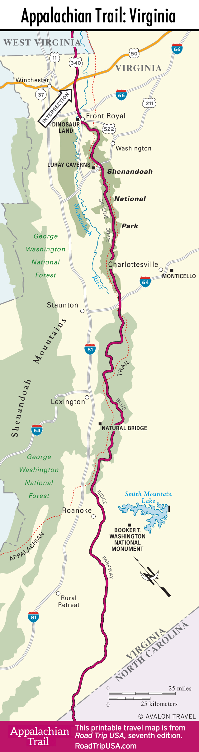
The Appalachian Trail covers more ground in Virginia than it does in any other state, following the crest of the Blue Ridge Mountains from Harpers Ferry in West Virginia all the way south to the Tennessee and North Carolina borders.
In the northern half of the state, the road route closely follows the hikers’ route, and the two crisscross each other through the sylvan groves of Shenandoah National Park. Midway along the state the two routes diverge, and hikers turn west while the motor route follows the unsurpassed Blue Ridge Parkway along the top of the world.
Most of the time the route follows the mountain crests, though in many places you’ll find fascinating towns and cities a short distance to the east or west. Best among these is Charlottesville, a history-rich Piedmont town that’s best known as the home of Thomas Jefferson and the University of Virginia. Other suggested stops include the Shenandoah Valley town of Lexington, the “natural wonder” of Natural Bridge, and the engaging city of Roanoke.
Virginia Travel Map
Related Virginia Travel Guides