New York
The Appalachian Trail through New York
According to the map, the Appalachian Trail’s corner-cutting path across the southern edge of New York state seems well outside New York City’s sprawl, but there is no escape from the greater reality of the urban northeast: This part of the Atlantic seaboard is the original megalopolis. The map may not make it obvious that some tens of millions of people live within an hour’s drive of this route, but the volume of traffic will.
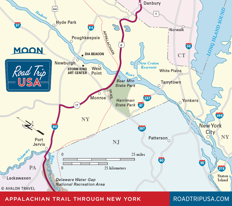
Between the Connecticut border and the Hudson River, many of the roads along the route of the Appalachian Trail have become heavily developed corridors of suburban malls and park-and-ride lots for Manhattan commuters, but there are also some fascinating parks and other places worth exploring:
- West Point – The hiker’s Appalachian Trail and our driving route both cross the Hudson River near West Point, the famous military academy
- Harriman State Park and Bear Mountain – These adjacent state parks are full of old-fashioned pleasures and hundreds of miles of hiking trails
- Port Jervis and Bethel – Port Jervis is a mix of small-town and commercial bustle near the Delaware River, while Bethel’s claim to fame is the original Woodstock Festival
Fans of urban adventure may wish to take a detour and explore the glorious buzzing mosaic that is New York City. As with other big cities, driving in New York City isn’t for the faint of heart. Save yourself some trouble (and wear-and-tear on your vehicle) by parking in a long-term lot and walking or taking the subway to get between points of interest.
Related New York Travel Guides