Sheffield or South Egremont
Sheffield: Antique Alley
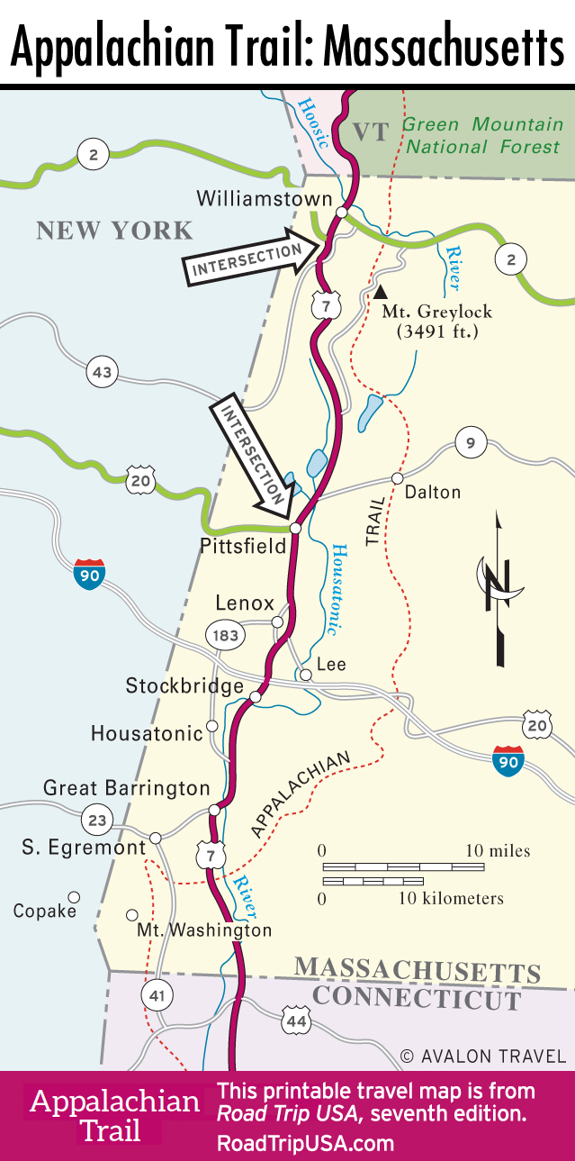
Between Great Barrington and the Connecticut state line, US-7 winds through Sheffield and is lined by dozens of antiques stores, earning this stretch the nickname “Antique Alley.” Sheffield also has a faded gray covered bridge, just over 100 yards east of US-7 on the north side of town. At the south edge of Sheffield, just west of US-7 off Weatogue Road, the natural rock garden of Bartholomew’s Cobble ($5) rises up above the west bank of the Housatonic River. Geology and weather have conspired to produce an outstanding diversity of plants and birds—800 species, including beautiful wildflowers—within a relatively small pocket of fern-covered limestone outcrops and broad meadows. At the center of the 329-acre state-run reserve, a pleasant walk up Hulburt’s Hill gives a broad view over the surrounding Berkshire scene.
Alternate Drive: Route 41
While US-7 gets the most tourist traffic, a more pastoral way south into Connecticut follows Route 41 via South Egremont, another of those well-preserved villages entirely ensconced in the National Register of Historic Places, which is hardly a rare honor in Massachusetts. At the center of town, The Old Mill (53 Main St., 413/528-1421) has been serving great soups, steaks, and more for more than 30 years.
South Egremont is the gateway to the state’s remotest corner, the over 4,600 forested ac (1,861 ha) of Mount Washington State Forest. Within its wooded boundaries are miles of hiking trails, including a stretch of the Appalachian Trail climbing up to the 2,607-ft (794-m) summit of Mt. Everett, but the highlight here is photogenic Bash Bish Falls, the highest in Massachusetts. A whopping 60-ft (18.2-m) drop, splashing down in a V-shaped pair of cascades, Bash Bish Falls is no Niagara, but it’s a nice place to while away a hot summer afternoon.
Related Travel Guides


Massachusetts Travel Map