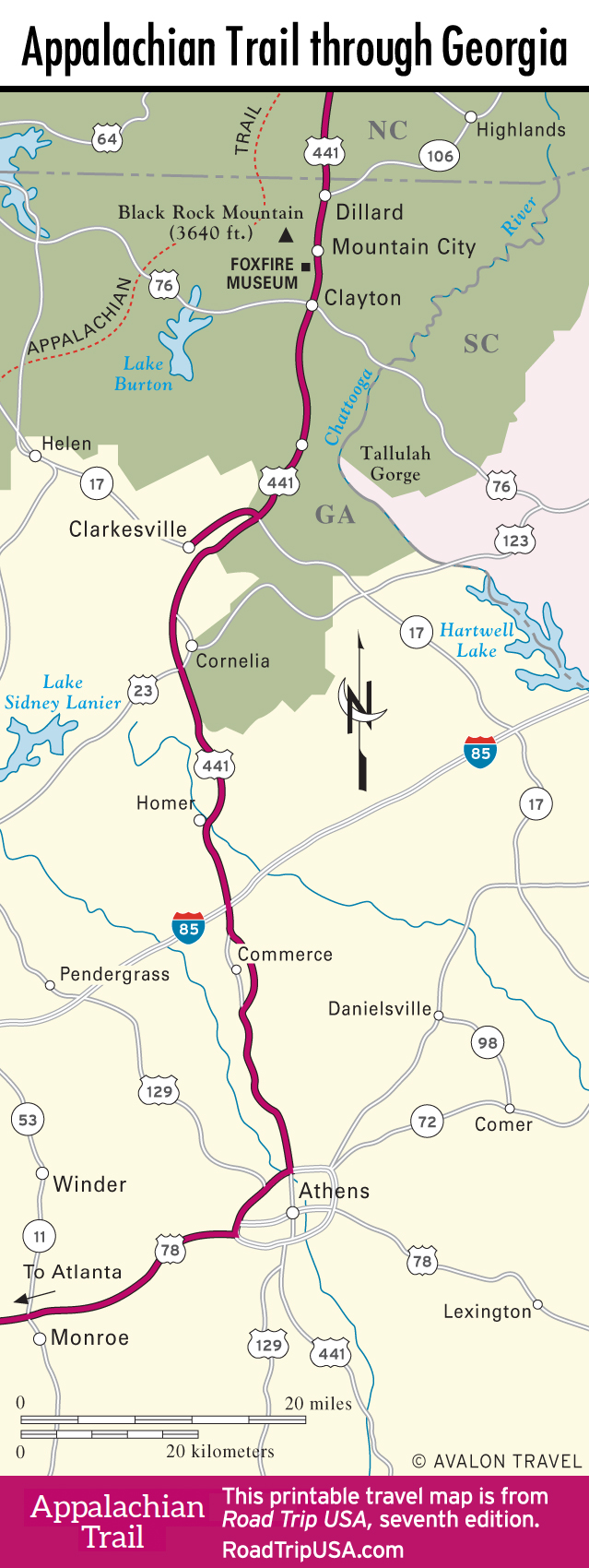
Tallulah Falls and Gorge
Balanced precariously between the US-441 freeway and the precipitous gorge that once held the thundering cascades of the Tallulah River, tiny Tallulah Falls (pop. 168) has an illustrious history. As word of the natural wonder spread, crowds were drawn to the breathtaking sight, and by the turn of the 20th century Tallulah Falls was a fashionable resort, with several elite hotels and boardinghouses catering to lowland sightseers. Fortunes changed when the falls were harnessed for hydroelectricity, but recent compromises have brought the falls back to occasional life. On weekends, usually in spring and fall, the waters are again released and can be admired from Tallulah Gorge State Park (706/754-7981), a pleasant park with a local interpretive center, camping, showers, hiking trails, and a cool suspension bridge over the river and gorge.
Stretching downstream along the six cascades of Tallulah Falls, the dramatic sheer walls of Tallulah Gorge have both haunted and attracted people for centuries. The wary Cherokee heeded legends that warriors who ventured in never returned, and many a curious settler had a waterfall or pool named in his honor—posthumously, after an untimely slip.
Tallulah Gorge is best seen via staircase-trails leading from the state park, or from the mile-long scenic route (old US-441), which loops off east of the modern highway. Drivers can pull over at numerous parking areas and take one of several rough trails along the gorge’s rim, though the best views are from the historic Tallulah Point Overlook (daily 9am-6pm, free), a privately owned concession stand midway along the loop.
Related Travel Guides


Georgia Travel Map